On April 27th I popped down to Vancouver Island to shoot a FortisBC + BC Ferries LNG bunkering. Here's a photo of the bridge of a BC Ferries vessel which is totally irrevelevant to this blog post but cool. The bridge has a mirror image with red LED's on the other side - depending which direction it is sailing. Very Star Trekish. On the return trip I was rubbernecking the Coquihalla Connector decent down into Okanagan Valley..... always spectacular..... when I happened to see a cave far above in the bluffs on Drought Mtn. I suspect this might just be a boy thing but I'm always intrigued by caves. I should note that this isn't the obvious big cave that's above Highway 97 and below the Connector. Mission spawned. I'd be back in the near future. The following day I plotted a route on Google Earth to Drought Mtn which...
The Monashee's are a gem that remain pristine considering their proximinty to the Okanagan Valley. I know of 6 appealing hikes based around Cherryville that are between 2-3 hours from Kelowna. There are more than that but some don't interest me as they are of similar distance without the reward of a sexy summit, alpine lake, or spectacular view. Twin Lakes is the easiest of all these hikes and I think this is my fifth trip to this location. Some of the photos were pulled from other trips as the weather was better. It's about 2:15 from Kelowna and a one way hike of 1:45. A logging road that requires a bit of clearance but not a four wheel drive takes you up to 1790m. The trail starts with a long up-hill which is always a bit of a grunt when you're not warmed up. Alongside the trail are lots of...
In the summer of 2013 I hiked into Divide Lake in Okanagan Mountain Park on a cell tower access road. Divide is a narrow lake near the summit that's wedged between two large rocks that resulted from some unpleasant tectonic rumblings. We spent the night at Divide lake and then dropped down the western slopes for 90 minutes to Baker Lake. It's the largest lake in the 10,000 hectare park and has a delighful little tent spot. It's ridiculously remote and terribly appealing. Divide Lake Filthy Divide Cabin Baker Lake It was this trip that really turned me on to the beauty of the park. It inspired me to spend too long on Google Earth planning future expeditions. After several more hikes and camps in the park I set my sights on an mysterious lake which is suspiciously big to be unnamed. I plotted out a route, plugged in my GPS...
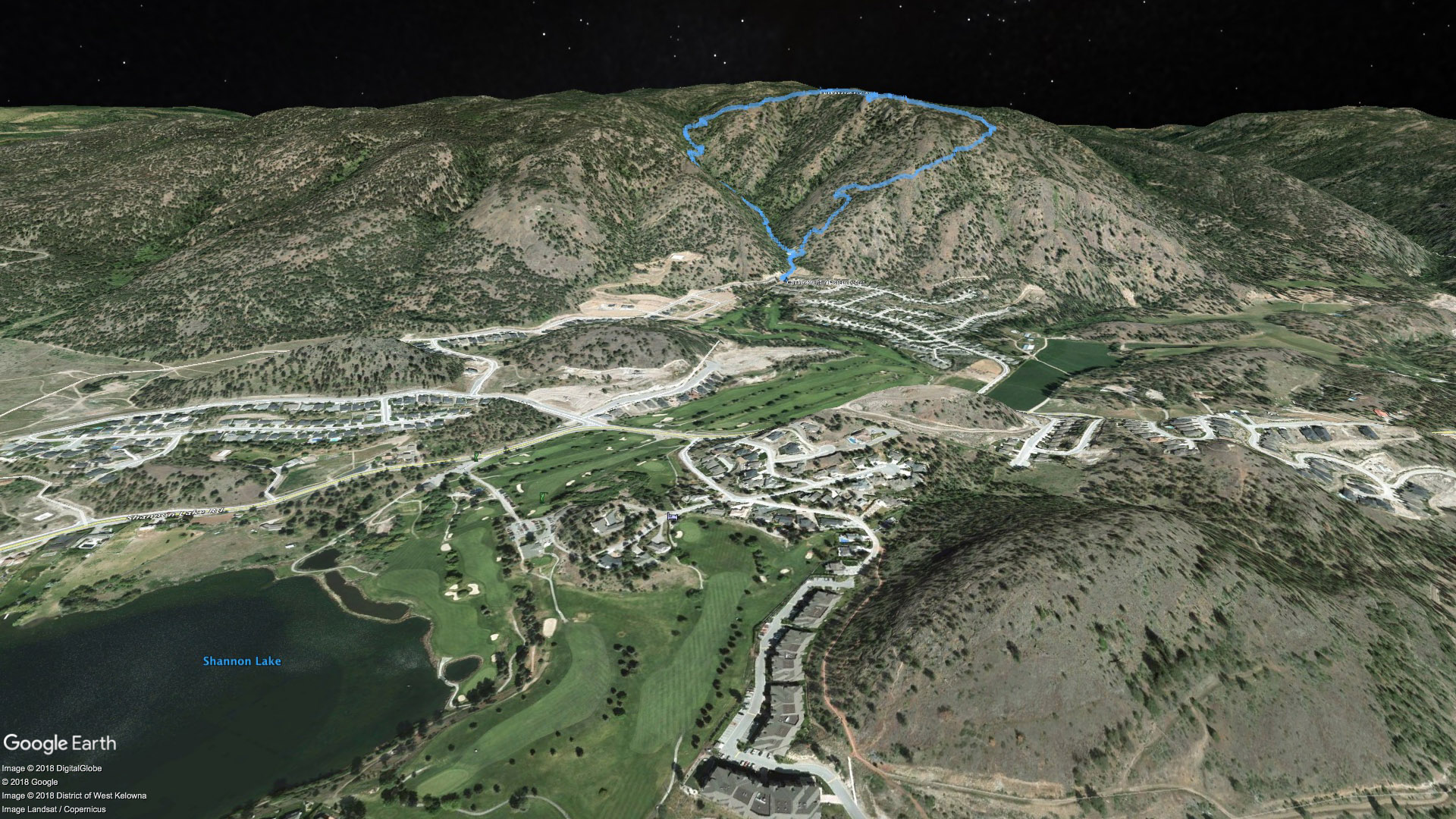
Finally got up Carrot Mountain in West Kelowna. Most hiking friends of mine have been up there and most seem to agree that it's a grunt. Compounding the grunt factor was the camera baggage. I was somewhere around 70lbs. Fortunately there is a waterfall about half way up that we were able to fill extra water bottles at so we didn't have to pack all the water all the way. This water source seemed to appear and disappear as we hiked. I suspect it is spring fed but we used the water for cooking and coffee and boiled it. The mosquitos in the valley on the hike up were positivley horrific. Once up top the southerly views are great over West Kelowna. The wind was absolutely howling so we were forced to camp away from the cliff edge to get some shelter. We chose to make a loop out of...
McDougall Rim is the prominent mountain to the west that can be seen from pretty much anywhere in Kelowna. It's gentle slope rises up to 1400m and is home to Hayman Lake which is actually more of a swamp. Below McDougall Rim is Rosevalley Resevoir which is a popluar hiking and biking destination. This is a sweet hike with spectacular views starting just after the 2km mark. It's a well used single track trail that climbs quite conistantly. It's not terribly steep but is long if you go to the top. There's no potible water and it's bear country so be prepared. Hiking access to McDougall Rim starts off of Bentley Rd. in West Kelowna above Bylands Nursery. After a couple of kilometres of private road you come to an obvious parking lot at the cattleguard. Mutliple atv/4x4 trails head up the hill to your right (north). If you stay right you'll...
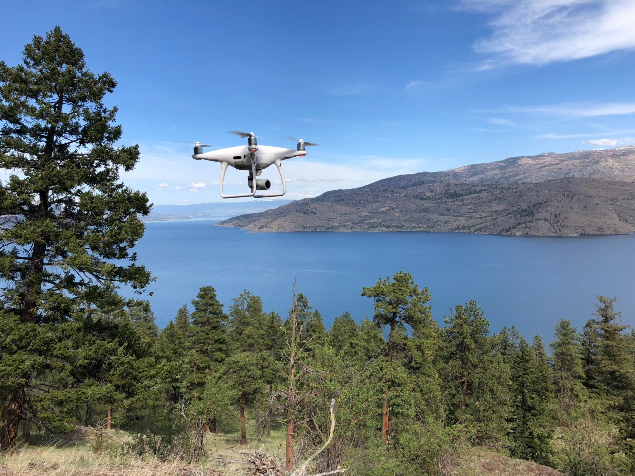
My latest piece of video production equipment is a drone which is also known as a UAV (Unmanned Aerial Vehicle) or a UAS (Unmanned Aerial System). To fly a drone commercially requires much more behind-the-scenes than you might think. Especially if it weighs more than a kilogram. You need to have training which includes safety protocals, aviation weather knowledge, knowledge of Transport Canada aviation regulations, Restricted Operators License - Aeronautical for a radio and more. You need a medical form from a doctor, a visual observer to be with you to help maintain security of the operation area and watch for hazards including other aircraft. You need to apply for a Special Flight Operations Certificate (SFOC) from Transport Canada which (at this point in time) requires an application for every commercial flight. These applications take as many as 22 business days to get approved. You must have maintenance procedures in place...
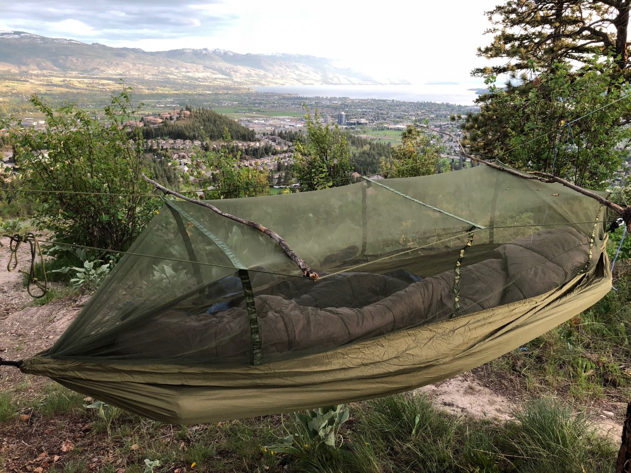
This was my first venture out with my daughter this year. My daughter, her friend and myself spent the night on top of the peak of Dilworth Mountain. It’s super easy walking access on a windy paved road that climbs steeply up to the radio towers. Because my daughter brought her friend I stayed in a hammock nearby which has a built in mosquito net and the kids took the tent. It was the first ever time camping for the young lady accompanying us and she was very excited. When you are on top of a mountain and you have nothing to do it forces you to take a step back and appreciate the beuty that surrounds you. the beuty can come in many different forms and especially when it's pointed out to you by a nine year old. I shot a few time lapses on this outing...