MAY
24

Renata Rock Arch and the return trip

20210522-DJI_0050 The Renata Rock Arch

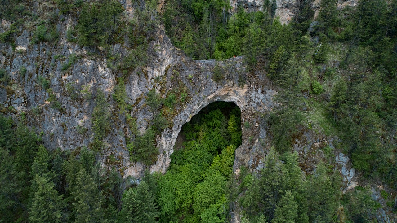
I stumbled across Renata Rock Arch last year sometime. Likely on Google Earth. The arch is actually a bridge as it was formed by erosion caused by the creek which runs under it whereas an arch is caused by 'erosion inherent in the rock'. It's apparently the largest in Canada at 44m wide, 4m thick, and 20m high.

The Arch resides on the west side of Lower Arrow Lake across from the tiny community of Deer Park. 4km north of the arch is Renata which was a community that was founded by three french prospectors in 1887 and then grew as a result of the CPR railway which is 6 miles away and now called the Trans Canada Trail. A quick google of Renata reveals a very interesting history that may intrigue you. Do it. To touch on that briefly the Columbia River Treaty was ratified in 1964 and the Arrow Dam flooded the region essentailly drowning out many of the communities on it's shores. Speaking with locals of the area we learned that three unwelcoming people now reside in Renata. An amusing story of one shooting the other in the leg over a property line dispute was shared. But I'm getting side tracked...

The Rock Arch is 341km from Kelowna with an additional 2 km to cross the beautiful Lower Arrow lake by boat. The lake is notorious for strong winds that can arise suddenly so I was trying to devise a back-up plan in case we encountrered wind that made canoe travel with lots of camera gear too risky. Jumping back to Google Earth revealed several logging roads that came close as well as the Trans Canada Trail that might make biking an option. I learned on the beach of Deer Park, the canoe take off point, that the houses in the area do have difficult road access but these properties all sport locked gates so accessing the arch by water is likely the best option.

Continue reading
  2776 Hits